|
Dry Tortugas National Park is a cluster of small, isolated islands at an important marine crossroads: the Florida Straits, where the Gulf of Mexico and the Caribbean Sea flow into the Atlantic Ocean. Combining these two corals records with three other Dry Tortugas coral cores that stretch back to 1733, the team was able to track 278 years worth of sea surface temperatures. The Dry Tortugas corals show that after a cold spell during the 1960s, sea surface temperatures in the region have warmed by about 1 degrees Fahrenheit between 1970 and 2012. This suggests that there is a close connection between sea temperatures in the area around the Dry Tortugas and the larger AMO. By looking at sea surface temperatures in the Dry Tortugas, climatologists may be able to predict imminent changes that will affect the entire North Atlantic basin, Flannery said. https://www.sciencedaily.com/releases/2017/01/170125091717.htm 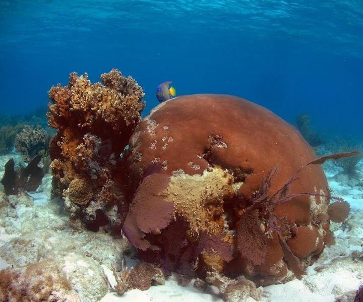
0 Comments
Regional sea-level scenarios: Helping US Northeast plan for faster-than-global rise 1/19/171/19/2017 The report, Global and Regional Sea Level Rise Scenarios for the United States, provides regional sea-level rise scenarios and tools for coastal preparedness planning and risk management. The report provides a range of possible scenarios, from at least 1 foot of global sea-level rise by 2100 to a worst-case rise that is 1.6 feet higher than a scenario in a key 2012 study that the report updates. The report also provides four additional global average sea-level rise scenarios through 2100: intermediate-low, intermediate, intermediate-high, and high. From Virginia through Maine and along the western Gulf of Mexico, sea-level rise is projected to be greater than the global average in nearly all global average sea level rise scenarios. For example, the sea in these regions would rise 1 to 1.6 feet higher than the global average rise of 3.3 feet under the intermediate scenario by 2100. https://www.sciencedaily.com/releases/2017/01/170119111004.htm 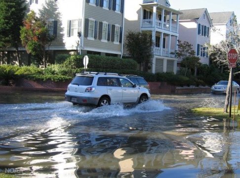 The subduction zone off the east coast of the archipelago racks up more intermediate-depth and deep earthquakes than any other subduction zone, where one plate of Earths lithosphere dives under another, on the planet. Analyzing data from several seismic surveys with both ocean bottom seismometers and island-based seismic stations, they were surprised to find a zone of intense earthquake activity in the downgoing slab, which they call a seismic belt. It looks like the seismic belt is produced by the sudden flushing of water when the slab warms up enough that the hydrated minerals can decompose and give off their water, said Doug Wiens, the Robert S. Brookings Distinguished Professor of earth and planetary sciences in Arts & Sciences at Washington University. Where the double seismic zone started to break down in Tonga, however, we saw this really active area of earthquakes that we named the seismic belt, Wiens said. The faster the slab was moving, the deeper the earthquakes, and the slower the slab, the shallower the earthquakes. https://www.sciencedaily.com/releases/2017/01/170111151428.htm  |
AuthorWrite something about yourself. No need to be fancy, just an overview. Archives
February 2017
Categories |
 RSS Feed
